Stay on grade.
On any machine.
On any job.

Our Goal: To build grade control every operation can afford, learn in a day, and trust

Ditch Assist® turns RTK GPS into grade control on the machines you already run. Surface drains, pads, terraces, land forming, tile, trenches: one app, one-time purchase, no subscription.

How it works

One RTK GPS on the implement. Three ways to run it.

The GPS on the implement tells the app on your tablet how far the cutting edge sits above or below your design. All three run the same app and the same Slope-IQ™ design screen. What changes is what goes on the machine, and who works raise/lower: you, following the arrows on the screen, or Ditch Assist, through our valve on your existing hoses or a compatible factory valve.

Illustration, not to scale.

Everything from day one. Ditch Assist works the hydraulics.

On the machine: your RTK GPS on a mast on the implement, the control module, and the proportional valve plumbed into your existing hoses.

Ditch Assist raises and lowers to the design, pass after pass, and you can take over from the cab at any time. Wi-Fi to the cab, no harness through the door.

See the kits

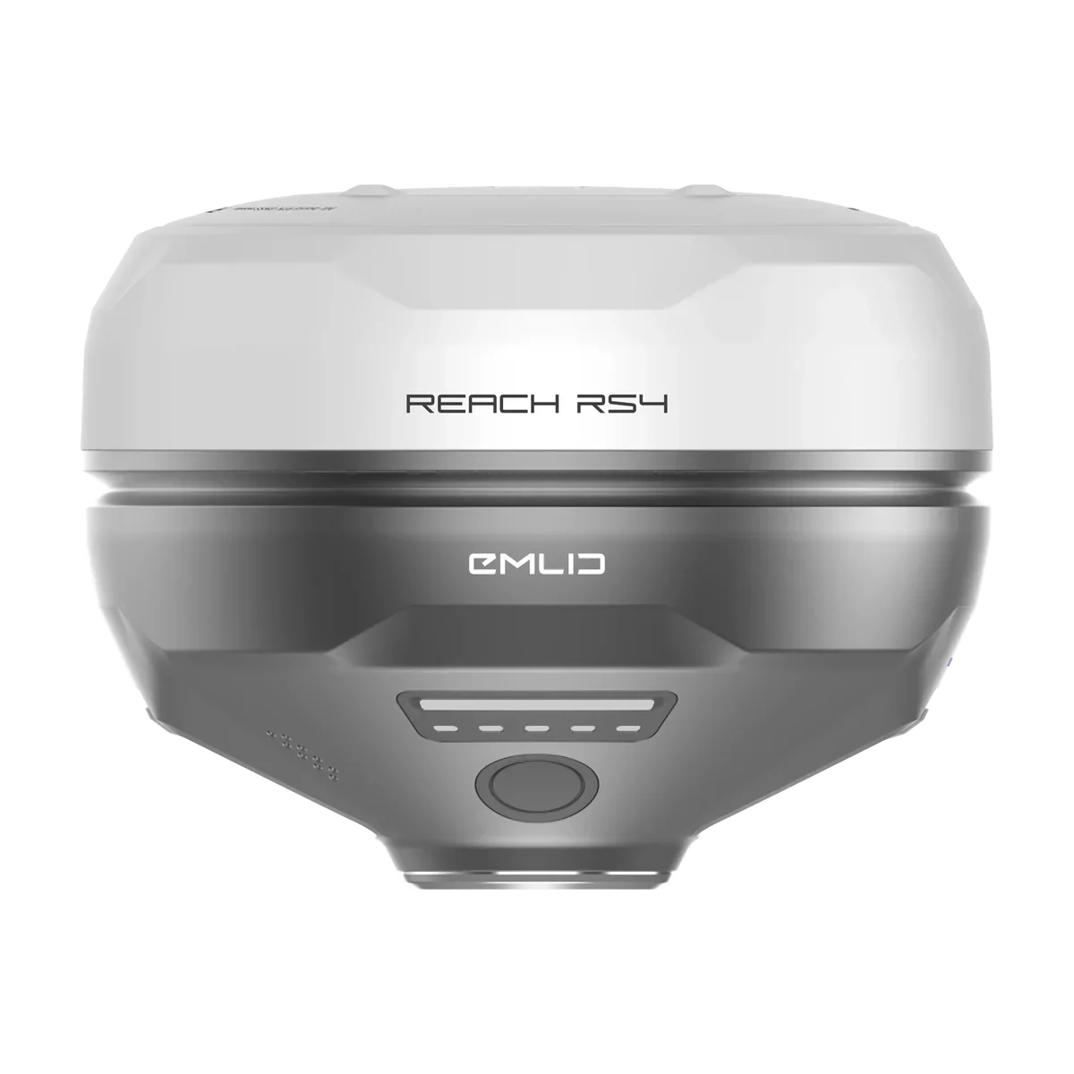
No RTK GPS yet? We bundle Emlid Reach RS4 and RS3 receivers as base and rover. See the RTK bundles

Full Automation Kit hardware: control module, proportional valve, hoses and harness
Full Automation Kit
Engineered in Manitoba · Used in 15+ countries

Field-proven since 2014.

Built by farmers and precision-ag people who run the equipment. Running across Canada and the United States, and in Mexico, Guatemala, Costa Rica, Panama, Colombia, Brazil, Argentina, Paraguay, Norway, South Africa, Australia, Japan and more.

“Oh man, world of a difference. Crazy what that thing can do. Paid for itself pretty quick, especially with this year.”

Logan Parkland Region, Manitoba

Lit up: some of the countries where Ditch Assist is running · Find a dealer

“Looking at the price of known systems for GPS dirt grade control systems, we thought this technology was out of reach for us… After talking with their team, I was almost in disbelief at their technology capability and price point!”

Ross Boarman Specialty Ag Work Inc. — Calhoun, Kentucky

“Seeing my customers save time, improve their work, and come back to tell me how well it’s working is what makes this job rewarding. Ditch Assist is a very simple, affordable system — and ease of training the operator makes it a breeze to support.”

Cody Olson Precision Farming Specialist · Titan Machinery — Ada & Winger, Minnesota

Map it. Survey it. Design it. Cut it.

The whole job runs in one app on the tablet in your cab. Here it is on a ditch, step by step, with the real screens and the app’s own design rules.

Map: see where the water goes before you drive the field.

Flow routes, ponding risk and the true low spots, from public LiDAR. Fetch it while the tablet has internet; it stays on the tablet for the field.

Flow routes layer over a field Ponding risk layer over a field Depressions layer over a field

Satellite cache, saved LiDAR DEMs, drainage maps, and Geo-Surface™ owner portal access — ready before field work.*

Explore LiDAR Drainage Mapping →

* Subject to public LiDAR availability — coverage across the contiguous US; in Canada, major ag regions of Manitoba, Saskatchewan, and Alberta, with coverage expanding.

Survey: drive the run once.

The app records the ground as you drive and draws the profile under the map, so you see the humps and low spots before you design anything.

Survey recording: the driven route on the map and the ground profile below it
  • Map on top. The route you drove, over the satellite map and LiDAR layers you saved.
  • Profile below. The ground along the run, recorded as you go.
  • Accuracy watched. Points taken while the RTK fix is in doubt are left out of the survey.

Design: Slope-IQ™ works out the grade.

This is the app’s design screen, working on a sample survey. Switch design modes, change the settings, and watch the cut, the volume and the pass count update.

Slope-IQ Design
DESIGN Grade Max Cut Avg Cut Length Drop Cut Vol

Sample 1,310 ft survey. The design rules are the app’s own; your survey will give its own design.

Cut: Auto-Nudge™ takes it down in passes.

Set the deepest cut your machine can pull in one pass. Auto-Nudge™ sets each pass target from the original ground, never deeper than that and never below final grade. Finish the pass, tap Pass +, and the next one is ready.

Illustration. Vertical scale exaggerated.
AUTO-NUDGE
Max cut2.0 in
Pass 1of 6
This pass, up to2.0 in
Left to final grade11.0 in

Auto-Nudge™ runs on all three setups. Where Ditch Assist works raise/lower, it follows each pass’s target; where you do, as with Ditch Assist Lite, you work the controls to match it.

Shown here on a ditch. Each mode page walks through its own version of these steps. Pick your job ↑

The app

The app you run in the cab.

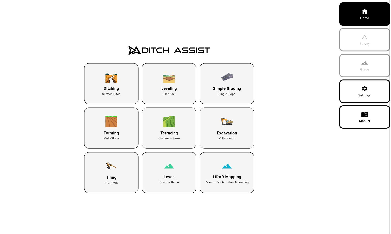
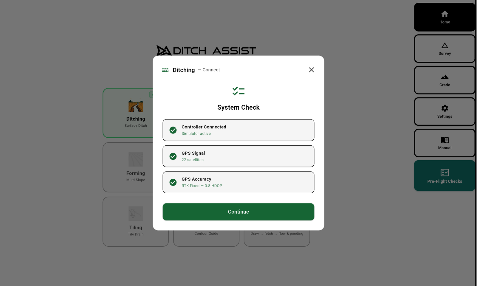
A wizard for every step, screens you can read at a glance, and accuracy watched for you. Pick one to see the real screen.

Ditch Assist app home screen Ditching system check Grading profile expanded Grading screen in the Sunlight display Saved field benchmark, calibrated

Standard Android tablet (Samsung Galaxy Tab A11+ recommended) · Wi-Fi to the cab, no harness through the door · As little as 20 minutes to move between machines

Always up to date.

Download the Ditch Assist Android app direct from our website. The app is free: the kit, or the Ditch Assist Lite license, is the one-time purchase. No subscription, no per-mode activation, and new features ship to every kit and Ditch Assist Lite at once.

Full UI and operator manual in English, Spanish, and Brazilian Portuguese. Choose Dark or Sunlight display and Imperial or Metric units from Settings.

For owners

Already run Ditch Assist? From first launch to field-ready.

  1. Unlock LiDAR Drainage Mapping.

    Connect once to a Ditch Assist control module, DIG™ Kit or licensed Ditch Assist Lite receiver. That unlocks the LiDAR & Mapping card on the app’s home screen, and it stays unlocked unless you reinstall the app.

  2. Prepare before you lose internet.

    Fetch LiDAR, build flow, depression, and ponding layers, and cache satellite imagery for offline field use.

  3. Connect in the cab.

    Join the module’s Wi-Fi, or the receiver’s Wi-Fi on Ditch Assist Lite. Confirm the controller connection and a valid RTK fix. If Ditch Assist works your raise/lower (Full Automation Kit, or a Guidance Only Kit plugged into a compatible factory valve), check hydraulic control too.

  4. Pick the job mode.

    Once the system checks pass, choose the workflow that matches the machine and the job.

Owner portal included

Use Geo-Surface from the office.

Ditch Assist owners get complimentary portal access to draw or import field boundaries, fetch LiDAR, generate flow and ponding maps, and save geo-referenced images for Ditch Assist reference layers.

Geo-Surface owner portal showing LiDAR flow and ponding layers

Tell us the machine and the job.

What you pull, push or dig with, the GPS you run, and the work you do most. We’ll tell you which setup fits.

Or try the app simulator first →